Three-Dimensional Volume Representation for Geospatial Data in Voxel Models
- AuthorsF. Tanner, D. Crispell, and R. Isbell
- Date13 March 2012
- SourceASPRS 2012 Annual Conference
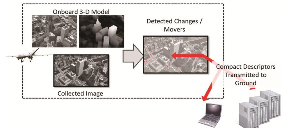
Extracting useful geospatial data from imagery is a fundamental challenge that has seen significant growth over the years as technology advances have been brought to bear on the problem. An important component of this problem addresses how the data should be represented to ensure the information content is accurately captured, preserved, and conveyed to consumers. Much of the information contained in the imagery is redundant and should be transformed so that only the essential information is retained and stored, allowing the redundant data to be discarded. An efficient mechanism for achieving this goal is the 3D Voxel model.