Automatic Geo-location Correction of Satellite Imagery
- AuthorsOzge C. Ozcanli, Yi Dong, Joseph L. Mundy, Helen Webb, Riad Hammoud, Victor Tom
- Date23 June 2014
- SourceInternational Journal of Computer Vision (IJCV), Volume 116, Issue 3, pp 263-277
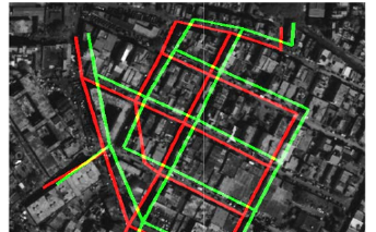
Modern satellites tag their images with geolocation information using GPS and star tracking systems. Depending on the quality of the geopositioning equipment, errors may range from a few meters to tens of meters on the ground. In this paper, an automatic geolocation correction framework that corrects images from multiple satellites simultaneously is presented. As a result of the proposed correction process, all the images are effectively registered to the same absolute geodetic coordinate frame.