Geo-localization using Volumetric Representations of Overhead Imagery
- AuthorsOzge C. Ozcanli, Yi Dong, Joseph L. Mundy
- Date04 February 2016
- SourceInternational Journal of Computer Vision (IJCV), Volume 116, Issue 3, pp 226-246
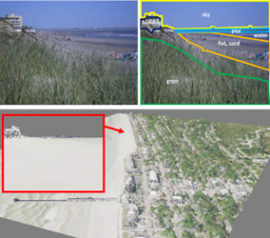
This paper addresses the problem of determining the location of a ground level image by using geo-referenced overhead imagery. The input query image is assumed to be given with no meta-data and the content of the image is to be matched to a priori constructed reference representations. The proposed 3D geo-localization framework performs better than the 2D approach for 75 % of the query images.